Flood-prone state road gets temporary fix
A section of Route 12, just north of the village of Rodanthe, North Carolina, increasingly has become flood-prone over the past decade due in part to rapid beach erosion in the area; wind-driven waves from a slow-moving mid-November storm buckled and undermined approximately 800 ft of pavement, flattened 900 ft of 15-ft to 20-ft-high sand dunes, and damaged hundreds of sandbags placed by NCDOT following a 2007 storm event; the North Carolina Department of Transportation has decided to relocate 1,800-ft-long stretch of the highway
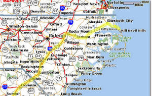
North Carolina's Route 12 // Source: truecompanion.net
A contractor last month completed relocation of a 1,800-ft-long flood-prone stretch of state Route 12 on Hatteras Island, North Carolina, but a longer-term plan to elevate other parts of the highway faces potential delays.
RNR’s Jim Parsons writes that RPC Contracting Inc., of Kitty Hawk, North Carolina, began work in late November on a $439,600 lump-sum contract to shift the 1,800-ft stretch of roadway 23 ft to the west, placing it at the edge of the North Carolina Department of Transportation’s (NCDOT) right-of-way through the Pea Island National Wildlife Refuge.
Construction was completed by 11 December, after which the contractor would have faced liquidated damages of $5,000 per day.
The relocated section of Route 12, just north of the village of Rodanthe, increasingly has become flood-prone over the past decade due in part to rapid beach erosion in the area. Wind-driven waves from a slow-moving mid-November storm buckled and undermined approximately 800 ft of pavement, flattened 900 ft of 15-ft to 20-ft-high sand dunes and damaged hundreds of sandbags placed by NCDOT following a 2007 storm event. “It looked like a war zone,” says NCDOT Division Engineer Jerry Jennings. Continued overwash conditions stymied repair work for several days, virtually stranding Hatteras Island’s 5,000 permanent residents.
NCDOT eventually was able to create a four-wheel-drive-only route across the sand adjacent to the washout area, while temporary vehicle ferry service between Rodanthe and the mainland allowed food and other essential items to be brought onto the island. The agency subsequently placed a layer of stone topped with asphalt over the old pavement, providing a rough but passable two-way road surface in time for Thanksgiving weekend, typically the final revenue-generating opportunity of the year for Hatteras Island’s largely tourist-based economy.
Roberson Contracting Inc., Williamston, North Carolina, now is resuming a previously planned $1.4-million beach-replenishment project adjacent to Route 12 that will use 200,000 cu yd of sand pumped approximately 10 miles from the north end of Hatteras Island. The replenishment and sandbag repair work is expected to take three to four months to complete.
“We are still getting a handle on the total cost of the repairs, but it will likely be more than $1 million,” Jennings says. “In the meantime, we will have to keep our fingers crossed that we do not have any more storms this season.”
A $1.4-billion plan to replace the aging 2.7-mile Bonner Bridge across Oregon Inlet includes using low-rise bridges to elevate this and other flood-prone portions of Route 12, thereby minimizing the effects of erosion and storm overwash on traffic. However, progress on replacing the bridge has slowed in recent months, with a Federal Highway Administration Record of Decision now due in early January 2010 and design-build contracts set to be awarded by midyear. The bridge portion of the project is scheduled for completion in 2014.
Even if Hatteras Island enjoys a relatively benign winter, Route 12’s long-term viability remains a concern. “Everyone recognizes that a long-term fix to the Rodanthe overwash area is needed and that bridging is a reasonable alternative,” Jennings says. “This event will hopefully make this work a higher priority.”