Law enforcementTurf wars: math model shows crimes cluster on borders between rival gangs
A mathematical model that has been used for more than eighty years to determine the hunting range of animals in the wild holds promise for mapping the territories of street gangs; among other things, the research demonstrates that the most dangerous place to be in a neighborhood packed with gangs is not deep within the territory of a specific gang, as one might suppose, but on the border between two rival gangs
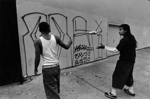
Gang members marking their territory // Source: destinyschildren.org
A mathematical model that has been used for more than eighty years to determine the hunting range of animals in the wild holds promise for mapping the territories of street gangs, a UCLA-led team of social scientists reports in a new study.
“The way gangs break up their neighborhoods into unique territories is a lot like the way lions or honey bees break up space,” said lead author P. Jeffrey Brantingham, a professor of anthropology at UCLA.
A UCLA release reports that the research further demonstrates that the most dangerous place to be in a neighborhood packed with gangs is not deep within the territory of a specific gang, as one might suppose, but on the border between two rival gangs. In fact, the highest concentration of conflict occurs within less than two blocks of gang boundaries, the researchers discovered.
The findings appear online in Criminology, a scholarly journal published by the American Society of Criminology, the world’s largest society of scholars conducting research on crime.
“Maps of gang territories provide police with a better understanding of how to allocate resources,” said research co-author George E. Tita, an associate professor of criminology, law and society at UC Irvine. “So figuring out the most accurate approach is really important for effectively deploying law enforcement.”
Currently, law enforcement agencies map gang territories based on police observation of such clues as graffiti and where gang members hang out. In these maps, geographic features like streets, parks and schoolyards typically delineate gang territories.
For the Criminology study, the team used Lotka-Volterra equations, which were designed to model the population dynamics of species competing for common resources. Since the 1930s, ecologists have used the equations to study the relationships between competing groups as diverse as bee colonies, troops of chimpanzees and prides of lions.
The equations are based on the principle that competition between groups determines where the boundaries between rivals form, and even a tiny amount of competition is enough to cause territories to form.
“What’s at work is a competitive balancing act where both gangs are trying to keep their rival as far away as possible,” Brantingham said.
The model the researchers derived from the equation predicted that gang boundaries would form midway between the home bases of rivals and would run in a perpendicular line between them.
The release notes that the team looked at thirteen gangs in the 6.5-square-mile area of Boyle Heights, a densely populated neighborhood