-
Drought-driven use of underground water threatens water supply of western U.S.
Scientists find that more than 75 percent of the water loss in the drought-stricken Colorado River Basin since late 2004 came from underground resources. The Colorado River is the only major river in the southwest part of the United States. Its basin supplies water to about forty million people in seven states, as well as irrigating roughly four million acres of farmland. Monthly measurements in the change in water mass from December 2004 to November 2013 revealed the basin lost nearly 53 million acre feet (65 cubic kilometers) of freshwater, almost double the volume of the nation’s largest reservoir, Nevada’s Lake Mead. More than three-quarters of the total — about 41 million acre feet (50 cubic kilometers) — was from groundwater. The extent of groundwater loss may pose a greater threat to the water supply of the western United States than previously thought.
-
-
Remote cameras monitor Montana wildfires
Fire officials on the Powell District of the Nez Perce-Clearwater National Forest, in partnership with the University of Montana, are testing a system of cameras remotely to monitor wildfires. The district has cameras mounted on two fire lookout towers and a third mobile camera that can be deployable as needed. Operators at the Powell Ranger Districtcontrol the cameras to provide multiple viewpoints of the targeted area.
-
-
Updating information about U.S. regional earthquake hazards
The USGS recently updated their U.S. National Seismic Hazard Maps, which reflect the best and most current understanding of where future earthquakes will occur, how often they will occur, and how hard the ground will likely shake as a result. While all states have some potential for earthquakes, 42 of the 50 states have a reasonable chance of experiencing damaging ground shaking from an earthquake in fifty years (the typical lifetime of a building). Scientists also conclude that sixteen states have a relatively high likelihood of experiencing damaging ground shaking. These states have historically experienced earthquakes with a magnitude 6 or greater. To help make the best decisions to protect communities from earthquakes, new USGS maps display how intense ground shaking could be across the nation.
-
-
First federal funds for West Coast earthquake warning system
Efforts by California officials to expand an earthquake warning system for the West Coast gained ground last Tuesday as the House Appropriations Committeerecommended $5 million — the first federal funds specifically for the project — toward the warning system. Analysts project the system will cost $38.3 million to build, and $16.1 million a year to operate and maintain. The $5 million would allow the purchase and installation of additional sensors and hiring of staff.
-
-
How affordable is the U.S. National Flood Insurance Program?
There is often tension between setting insurance premiums that reflect risk and dealing with equity/affordability issues. The National Flood Insurance Program (NFIP) in the United States recently moved toward elimination of certain premium discounts, but this raised issues with respect to the affordability of coverage for homeowners in flood-prone areas. Ultimately, Congress reversed course and reinstated discounted rates for certain classes of policyholders.
-
-
As TRIA is set to expire in December, reauthorization by Congress is not a sure thing
After the 9/11 attacks, the U.S. insurance industry sustained an estimated $32.5 billion in total losses. In 2002, to encourage insurance companies to continue covering terrorism as part of commercial policies after many dropped the coverage for fear of more financial loss should another terror attack occur, Congress passed the Terrorism Risk Insurance Act(TRIA).There has yet to be a TRIA payout due to the absence of a large-scale terrorist attack since the law went into effect. With TRIA expected to expire on 17 December 2014, businesses and some members of Congress are advocating the extension of the legislation, but two pending proposals in Congress have yet to gather the needed support to reauthorize TRIA.
-
-
A drone finds natural disaster survivors through their cell-phones
During his semester project in Computer Science at the École polytechnique fédérale de Lausanne (EPFL), Jonathan Cheseaux developed a system for locating a person via his or her mobile phone with a drone. This device could be used to find victims in natural disasters.
-
-
Japan exceedingly vulnerable to sea level rise
Scientists say that Japan might be one of the most at-risk nations when it comes to the consequences of sea-level rise.Japan has a coastline 30,000 km long, and much of it in largely low-elevation regions. Additionally, about 80 percent of the country’s industry and population are located in these zones.
-
-
Debate in Texas over fossil fuel-based economic growth
Texas officials tout the state’s economic growth, which is due in part to the state’s energy sector. That same energy sector puts Texas’ economy at risk in decades to come, with scientists saying that this economic growth comes at a high cost.State climatologist John Nielsen-Gammon, who was appointed by then-Governor George W. Bush, notes that the state is projected to be several degrees warmer and experience longer and more severe droughts. The see along portions of the state’s 367-mile Gulf Coast has already risen up to one foot in the past century.
-
-
Demand for cyberattack insurance grows, but challenges remain
The surge in cyberattacks against the private sector and critical infrastructure has led to a growth in demand for cyber insurance; yet most insurers are unable properly to assess their clients’ cyber risk, let alone issue the appropriate pricing for their cyber coverage.Insurers which traditionally handle risks like weather disasters and fires, are now rushing to gain expertise in cyber technology.On average, a $1 million cyber coverage could cost $20,000 to $25,000.
-
-
Training volcano scientists from around the world to predict, respond to eruptions
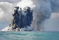
Scientists and technicians who work at volcano observatories in eleven countries visited the U.S. Geological Survey’s Hawaiian Volcano Observatory earlier this month to learn techniques for monitoring active volcanoes. The International Training Program in Volcano Hazards Monitoring is designed to assist scientists from other nations in attaining self-sufficiency in monitoring volcanoes and reducing the risks from eruptions.
-
-
Mapping Florida sinkholes
Sinkholes are common in Florida because of porous rock underground, such as limestone, which holds water. Over time, acid in the water dissolves the rock, creating a void. The Florida Geological Surveyand Florida Department of Emergency Managementare making progress on creating a statewide map showing where sinkholes are most likely to form. Florida received more than $1 million in federal funding last year to conduct a three-year study which would eventually help emergency planners predict where sinkholes are likely to develop, especially after large rainstorms.
-
-
California braces for worst wildfire season in memory
California Department of Forestry and Fire Protection(Cal Fire) is bracing for one of the longest and most difficult fire seasons in memory. A recent addition of $23 million to the emergency wildfire budget for the fiscal year that began 1 July, brings the department’s budget total to $209 million. “That’s just the first week, and we still have 51 more weeks to go,” said Daniel Berlant, spokesman for Cal Fire. “We’re not even to the peak of the fire season yet.”
-
-
Emergency readiness of health-care providers
In 2013 the Centers for Medicare and Medicaid Services(CMS) proposed new preparedness requirements for hospitals and sixteen other types of health care providers, including home health agencies, nursing homes, hospices, transplant centers, and community mental health facilities, to mitigate natural and man-made disasters. Health-care providers say these requirements are too costly.
-
-
New materials, designs needed to fortify infrastructure against extreme weather
As cities prepare for the effects of climate change, higher temperatures for longer periods of time and a dramatic change in humidity and rainfall pose the highest risk to public infrastructure, scientists say. Buildings, roads, and bridges which were built for one set of climate conditions will have to function in another. Researchers say that analysis of changing conditions in Alaska, for example, shows that in thirty or forty years the state would have to rebuild roads every eighteen months unless new designs and materials were adopted.
-
The long view
Trump Aims to Shut Down State Climate Policies
President Donald Trump has launched an all-out legal attack on states’ authority to set climate change policy. Climate-focused state leaders say his administration has no legal basis to unravel their efforts.