-
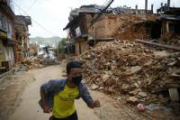
Emergency retweets can help in times of disaster
Twitter and other social media tools are commonly used around the world. Now, many government and not-for-profit organizations have a presence on at least one of these systems and use them in various ways to share information about their activities and engage with people. For organizations that work in disaster zones and emergency situations, these tools can also be used to coordinate activities, help raise funds and disseminate timely news that can help in relief efforts.
-
-
As the world ends, people remain calm and prosocial: Video-game study

As the world ends, will you lock arms and sing “Kumbayah” or embark on a path of law-breaking, anti-social behavior? A new study, based upon the virtual actions of more than 80,000 players of the role-playing video game ArcheAge, suggests you will be singing. “We realize that, because this is a video game, the true consequences of the world ending are purely virtual. That being said, our dataset represents about as close as we can get to an actual end-of-the-world scenario,” says one researcher.
-
-
Extreme sea levels could endanger European coastal communities
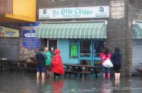
Massive coastal flooding in northern Europe that now occurs once every century could happen every year if greenhouse gas emissions continue to rise, according to a new study. New projections considering changes in sea level rise, tides, waves and storm surge over the twenty-first century find global warming could cause extreme sea levels to increase significantly along Europe’s coasts by 2100. Extreme sea levels are the maximum levels of the sea that occur during a major storm and produce massive flooding.
-
-
Louisiana wetlands threatened by with sea-level rise four times the global average
Without major efforts to rebuild Louisiana’s wetlands, particularly in the westernmost part of the state, there is little chance that the coast will be able to withstand the accelerating rate of sea-level rise, a new study concludes. The study shows that the rate of sea-level rise in the region over the past six to ten years amounts to half an inch per year on average.
-
-
Cyberterrorism threat must be addressed: Pool Re’s chief
Cyber is unlike any other peril, because of its theoretical ability to affect almost any insurance class. This significantly impairs (re)insurers’ ability to allocate capital, to model losses with confidence, and, as a result, to price insurance products accurately. The gap between the available global insurance capacity and market exposure has become increasingly stark: market capacity stands at approximately $500 million, but the exposure is estimated to be more than $130 billion. Pool Re, the U.K.’s $7.3 billion terrorism reinsurance fund, wants to extend its cover to include cyberattacks on property, chief executive Julian Enoizi said.
-
-
Predicting floods, hurricanes with social media
Social media can warn us about hurricanes, storms, and floods before they happen – according to new research. Key words and photos on social media can signal developing risks – like water levels rising before a flood. Researchers, who analyzed posts on Flickr between 2004 and 2014, found certain words – such as river, water, and landscape - take on distinct meaning of forecast and warning during time periods leading to extreme weather events. Words can be used as ‘social sensors’, to create accurate early warning system for extreme weather, alongside physical sensors.
-
-
More effective response to unpredictable disasters
When the unthinkable happens and the unpredictable takes over, crises cannot be handled by the book. Traditional emergency work emphasizes fixed procedures and strong leadership, as is typically exemplified by the police force. This approach works in most emergency situations – but not when the unthinkable happens. Evaluations of past events show that the scale of many disasters could have been reduced if local decision-making power had been greater — that is, if the part of the team that was closest to the situation had been involved in a different way.
-
-
How disaster relief efforts could be improved with game theory
The number of disasters has doubled globally since the 1980s, with the damage and losses estimated at an average $100 billion a year since the new millennium, and the number of people affected also growing. Hurricane Katrina in 2005 was the costliest natural disaster in the U.S., with estimates between $100 billion and $125 billion. The death toll of Katrina is still being debated, but we know that at least 2,000 were killed, and thousands were left homeless. Worldwide, the toll is staggering. The challenges to disaster relief organizations, including nongovernmental organizations (NGOs), are immense, and the competition among them is intense. My team and I have been looking at a novel way to improve how we respond to natural disasters. One solution might be game theory.
-
-
Offshore fault system could produce onshore magnitude 7.3 quake in southern California
A fault system that runs from San Diego to Los Angeles is capable of producing up to magnitude 7.3 earthquakes if the offshore segments rupture and a 7.4 if the southern onshore segment also ruptures, according to a new analysis. “This system is mostly offshore but never more than four miles from the San Diego, Orange County, and Los Angeles County coast,” says the lead author. “Even if you have a high 5- or low 6-magnitude earthquake, it can still have a major impact on those regions which are some of the most densely populated in California.”
-
-
Could fast radio bursts be evidence of alien probes?

The search for extraterrestrial intelligence has looked for many different signs of alien life, from radio broadcasts to laser flashes, without success. However, newly published research suggests that mysterious phenomena called fast radio bursts could be evidence of advanced alien technology. Specifically, these bursts might be leakage from planet-sized transmitters powering interstellar probes in distant galaxies.
-
-
New avalanche, snow burial practice guidelines
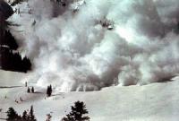
With the growing popularity of backcountry snow activities, it is increasingly important to understand the best techniques for avalanche rescue. Each year, there are over 150 avalanche fatalities in the US and Europe, with most deaths occurring among recreational groups that include skiers, snowboarders, snowmobilers, and mountaineers. The Wilderness Medical Society has issued new practice guidelines to help medical professionals, as well as the public, understand the latest techniques and recommendations for avalanche risk management and rescue protocols.
-
-
Knowledge gaps on protecting cultural sites from climate change
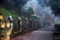
Researchers searched worldwide for peer-reviewed studies of cultural resources – archaeological sites, natural landscapes, and historic buildings — at risk due to climate change. About 60 percent of the studies referenced sites in Europe, most commonly in the United Kingdom. Another 17 percent of the research covered sites in North America, a majority of them in the United States. About 11 percent dealt with resources in Australia and the Pacific Islands and 10 percent mentioned Asia, mostly China. All but six of the 124 studies were published in English-language journals, with South America and Africa rarely represented in the research. “We see a significant gap in knowledge of how to adapt to climate change and preserve cultural resources for future generations,” says one researcher.
-
-
Better communication key to reducing earthquake death toll
A major problem in conveying earthquake risks to the public is that scientists are unable to predict when, where, and with what strength the next earthquake will strike. Instead, they use probabilistic forecasting based on seismic clustering. Earthquake experts have long grappled with the problem of how to convey these complex probabilities to lay persons.
-
-
California's San Joaquin Valley still sinking
Since the 1920s, excessive pumping of groundwater at thousands of wells in California’s San Joaquin Valley has caused land in sections of the valley to subside, or sink, by as much as 28 feet (8.5 meters). This subsidence is exacerbated during droughts, when farmers rely heavily on groundwater to sustain one of the most productive agricultural regions in the nation. Long-term subsidence is a serious and challenging concern for California’s water managers, putting state and federal aqueducts, levees, bridges, and roads at risk of damage. Already, land subsidence has damaged thousands of public and private groundwater wells throughout the San Joaquin Valley. Furthermore, the subsidence can permanently reduce the storage capacity of underground aquifers, threatening future water supplies.
-
-
Oroville dam danger shows how Trump could win big on infrastructure
This near catastrophe at Oroville dam — America’s tallest dam — is just the latest symptom of the chronic ill-health of America’s civil infrastructure, which has suffered from decades of under-investment and neglect. But the Oroville dam crisis could provide an unexpected opportunity for the new Trump administration to take on both problems – and win. The main problem in dealing with U.S. infrastructure is money, as up to $1 trillion would be required to repair or replace ageing dams, bridges, highways, and all the other components that support modern civilization. But there is a way for Trump to harness market forces and persuade corporate investors to invest in U.S. infrastructure. The Oroville dam near catastrophe demonstrates that some of the largest imminent threats to infrastructure will increase through climate change, and provides compelling evidence of the hard economic costs of inaction on infrastructure. If Trump moves away from climate change denial and accepts the strong balance of scientific evidence and opinion about human contribution t climate change, then a pathway to dealing with U.S. infrastructure could open up by appealing to “natural capitalism” – a market-driven economics which centers on the value of natural resources. Accepting man-made climate change could provide Trump with a chance to deliver on one of his major campaign promises, change the face of capitalism, and perhaps even save the world along the way.
-
The long view
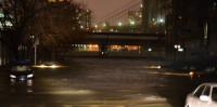
The Surprising Reasons Floods and Other Disasters Are Deadlier at Night
It’s not just that it’s dark and people are asleep. Urban sprawl, confirmation bias, and other factors can play a role.
Why Flash Flood Warnings Will Continue to Go Unheeded
Experts say local education and community support are key to conveying risk.