-
Evaluate AI capabilities in Helping Paramedics
Paramedics must make numerous life-saving decisions, often in the back of an ambulance with limited time. While they at times call doctors for additional medical directives, precious seconds tick away for the patient during these back-and-forth conversations. DHS S&T partnered with its Canadian counterpart to examine whether artificial intelligence could be used to improve that information overload.
-
-
This High-Tech Solution to Disaster Response May Be Too Good to Be True
The company called One Concern has all the characteristics of a buzzy and promising Silicon Valley start-up: young founders from Stanford, tens of millions of dollars in venture capital and a board with prominent names. Its particular niche is disaster response. And it markets a way to use artificial intelligence to address one of the most vexing issues facing emergency responders in disasters: figuring out where people need help in time to save them. That promise to bring new smarts and resources to an anachronistic field has generated excitement. But there are skeptics, and interviews and documents show the company has often exaggerated its tools’ abilities and has kept outside experts from reviewing its methodology.
-
-
Worst Rainfall in 150 Years Damages Pennsylvania Homes, Roads
According to the 150 years of data used by the National Weather Service, 2018 was the wettest year in the Berks region of Pennsylvania, with 68.08 inches of precipitation measured at Reading Regional Airport. This year is ahead of last year’s pace, with 38.21 inches already, far above the normal rate of 24.18 inches. Records for the wettest 12-month period are being set each month, according to the weather service. Some municipal officials say their infrastructure and stormwater management systems can’t handle the amount of rain we’re now receiving, and they are trying to figure out what type of improvements they can afford.
-
-
Keeping First Responders Safe
When two powerful earthquakes rocked southern California earlier this month, officials’ attention focused, understandably, on safety. How many people were injured? Were buildings up to code? How good are we at predicting earthquakes? Not a lot of people were thinking about urine, blood, and spit. But those substances are key to a PNNL effort to learn more about the health and safety of first responders.
-
-
Assessing Handheld Explosives Trace Detectors
Individuals who carry explosives or have been involved in bomb making are likely to be contaminated with trace explosives, microscopic particles invisible to the naked eye. Without the right equipment, detecting trace explosives can be challenging for responders and security personnel. Handheld explosives trace detectors (ETDs) can be used to complement bomb-sniffing canines, which are still the gold standard in trace explosives detection. These detectors can be used to find trace explosives on individuals, hopefully preventing a dangerous incident.
-
-
New Sensor Improves Earthquake Response Efforts
The recent massive southern California earthquakes shut down Ridgecrest Regional Hospital throughout the 4 July holiday weekend while the tiny town of Ridgecrest assessed the damages. Researchers developed a new optical sensor which could speed up the time it takes to evaluate whether critical buildings like these are safe to occupy shortly after a major earthquake.
-
-
Helping first responders deal with dirty bombs
If a radiological dispersal device (RDD), or “dirty bomb,” ever explodes in the United States, emergency crews may be better prepared because researchers have developed a new simulator, which show first responders what an optimal response to an RDD would look like.
-
-
Medical Drones for Accident and Emergency
Drones could revolutionize the way in which emergency medical supplies, such as bags of blood plasma, are delivered to areas hit by disaster, accidents or other life-threatening situations. Research have undertaken a cost analysis of using drones for this purpose.
-
-
First Responder Radiological Preparedness
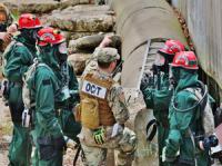
A radiological dispersal device (RDD), or “dirty bomb,” detonation in a local jurisdiction will have significant consequences for public safety, responder health and critical infrastructure operations. First responders and emergency managers must quickly assess the hazard, issue protective action recommendations, triage and treat the injured, and secure the scene in support of the individuals, families and businesses in the impacted community.
-
-
AI helps protect emergency personnel in hazardous environments

Whether it’s at rescue and firefighting operations or deep-sea inspections, mobile robots finding their way around unknown situations with the help of artificial intelligence (AI) can effectively support people in carrying out activities in hazardous environments.
-
-
Satellite observations help in earthquake monitoring, response
Researchers have found that data gathered from orbiting satellites can provide more accurate information on the impact of large earthquakes, which, in turn, can help provide more effective emergency response.
-
-
Drones help in early detection of forest fires
Researchers have developed a drone-based system for early detection and prevention of forest fires through drone technology. Sensors can detect fire from 15 kilometers away, and autonomously send drones to investigate, even in conditions of limited visibility, and gathers optic and thermal images of the fire, which the drone sends back in real time.
-
-
Showing emergency responders the fastest, safest path to incident scenes
Getting to your destination has never been easier, thanks to a number of popular global positioning systems (GPS) -based navigation apps available for download on smart devices. For first responders, there can be drawbacks to using the same apps and following the same routes as everyone else. When every second counts getting to an emergency scene, good enough just won’t cut it.
-
-
Small device alerts responders to changes to thermal conditions
When firefighters rush into burning buildings, they know the thermal environment may change in a matter of seconds, exposing them to potentially lethal temperatures. Burn Saver is a body-worn technology that continuously monitors thermal conditions and warns firefighters when those conditions become threatening.
-
-
S&T seeking partners for first responder technology R&D

DHS S&T said it was inviting industry, academia, laboratories, and the innovation community to submit white papers related to twelve first responder technology funding opportunities. S&T said that each of the twelve topic areas “represent technology needs identified by responders themselves, and we are seeking the best partners to turn these needs into solutions.”
-
- All
- Regional
- Water
- Biometrics
- Borders/Immig
- Business
- Cybersecurity
- Detection
- Disasters
- Government
- Infrastructure
- International
- Public health
- Public Safety
- Communication interoperabillity
- Emergency services
- Emergency medical services
- Fire
- First response
- IEDs
- Law Enforcement
- Law Enforcement Technology
- Military technology
- Nonlethal weapons
- Nuclear weapons
- Personal protection equipment
- Police
- Notification /alert systems
- Situational awareness
- Weapons systems
- Sci-Tech
- Sector Reports
- Surveillance
- Transportation
Advertising & Marketing: advertise@newswirepubs.com
Editorial: editor@newswirepubs.com
General: info@newswirepubs.com
2010-2011 © News Wire Publications, LLC News Wire Publications, LLC
220 Old Country Road | Suite 200 | Mineola | New York | 11501
Permissions and Policies
Editorial: editor@newswirepubs.com
General: info@newswirepubs.com
2010-2011 © News Wire Publications, LLC News Wire Publications, LLC
220 Old Country Road | Suite 200 | Mineola | New York | 11501
Permissions and Policies
