-
Cape Cod susceptible to potential effects of sea-level rise
Cape Cod is vulnerable to rising water tables and, in some areas, groundwater inundation as a result of rising sea levels, according to a new U.S. Geological Survey study (USGS). Groundwater inundation occurs when the water table reaches or exceeds land surface. The challenges associated with the issue are likely to become more prevalent as seas rise. Depending on the severity, it may make areas unsuitable for residential and commercial development.
-
-
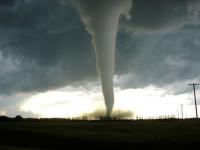
NIST leads federal effort to save lives, property from windstorms

Congress recently designated NIST to be the lead agency for the National Windstorm Impact Reduction Program (NWIRP). In one of its first actions as lead agency, NIST has announced in the Federal Register that it is establishing a panel of external experts to “provide advice on windstorm impact reduction and represent related scientific, architectural and engineering disciplines.”
-
-
Breaking records: The first six months of 2016 the warmest half-year on record
Two key climate change indicators — global surface temperatures and Arctic sea ice extent — have broken numerous records through the first half of 2016. While these two key climate indicators have broken records in 2016, NASA scientists said it is more significant that global temperature and Arctic sea ice are continuing their decades-long trends of change. Both trends are ultimately driven by rising concentrations of heat-trapping carbon dioxide and other greenhouse gases in the atmosphere.
-
-
What do climate tipping points mean for society
The phrase “tipping point” passed its own tipping point and caught fire after author Malcolm Gladwell’s so-named 2000 book. It is now frequently used in discussions about climate change, but what are “climate tipping points”? And what do they mean for society and the economy? In a new study, scientists tackle the terminology and outline a strategy for investigating the consequences of climate tipping points. The authors recommend using the phrase “climatic tipping elements” to describe portions of the climate system that may be abruptly committed to major shifts as a result of the changing climate.
-
-
Assessing climate change risks to U.K.
Climate change is happening now. Globally, 14 of the 15 hottest years on record have occurred since 2000. The impacts of climate change are already being felt in the United Kingdom, and urgent action is required to address climate-related risks, the Committee on Climate Change’s (CCC)’s Adaptation Sub-Committee (ASC) said the other day.
-
-
100s of deaths in two cities in 2003 heatwave due to man-made climate change: Scientists

Scientists have specified how many deaths can be attributed to man-made climate change during an extreme heatwave in two European cities in 2003. The study says that with climate change projected to increase the frequency and severity of future heatwaves, these results highlight an emerging trend. The authors suggest that such research gives policymakers better information about the damaging effects of heatwaves to help them respond to the future challenges of climate change.
-
-
U.S. suffered at least $8 billion climate-related disasters so far this year
We are only halfway through 2016 and the United States has already seen eight weather and climate-related disasters* that have each met or exceeded $1 billion in damages. These eight disasters resulted in the loss of thirty lives, and caused at least $13.1 billion. Since 1980 the United States has sustained 196 weather and climate disasters in which overall damages/costs reached or exceeded $1 billion. The total cost of these 196 events exceeds $1.1 trillion.
-
-
June was the warmest on record for contiguous U.S.
Summer is off to a sizzling start. The average June temperature for the Lower 48 states was 71.8 degrees F, making it the warmest June on record. Above-average temperatures spanned the nation from coast to coast, and seventeen states across the West, Great Plains, and parts of the Southeast experienced temperatures much above average. June precipitation for the contiguous U.S. averaged 2.46 inches, 0.47 inch below average, ranking as the fourteenth driest on record.
-
-
Impact of demographic development on fires in ecosystems as strong as that of climate change
Every year, about 350 million hectares of land are devastated by fires worldwide. This corresponds to about the size of India. To estimate the resulting damage to human health and economy, precise prognosis of the future development of fires is of crucial importance. Previous studies often considered climate change to be the most important factor. Now, a group of scientists has found that population development has the same impact at least.
-
-
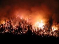
Learning to live with wildfires: how communities can become “fire-adapted”
In recent years wildfire seasons in the western United States have become so intense that many of us who make our home in dry, fire-prone areas are grappling with how to live with fire. We know that fuel reduction in dry forests can mitigate the effects of wildfires. After decades of fire exclusion, dense and dry forests with heavy accumulations of fuel and understory vegetation often need to be treated with a combination of thinning and prescribed burning. Native peoples, less than 150 years ago, proactively burned the landscapes we currently inhabit – for personal safety, food production, and enhanced forage for deer and elk. In some places, people still maintain and use traditional fire knowledge. As we too learn to be more fire-adapted, we need to embrace fire not only as an ongoing problem but an essential part of the solution.
-
-
Coconut shells inspire design ideas for earth-quake proof buildings

Coconuts are renowned for their hard shells, which are vital to ensure their seeds successfully germinate. Coconut palms can grow 30-meter high, meaning that when the ripe fruits fall to the ground their walls have to withstand the impact to stop them from splitting open. The specialized structure of coconut walls could help to design buildings that can withstand earthquakes and other natural disasters.
-
-
Electromagnetic fields could be used in tsunami early warning
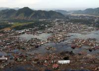
Could electromagnetic (EM) fields be used in tsunami early warning? New research shows that important focal parameters of tsunamigenic earthquakes — particularly fault dip direction — can be extracted from tsunami-borne EM fields.
-
-
Lessons learned from the U.S.-Canada cross-border experiment
A tornado has just devastated a community on the border between the United States and Canada. Paramedics scramble to bring patients from over-crowded hospitals across the border. Communication blackouts and downed trees force ambulances to weave their way through blowing debris, fallen electrical lines, and car wrecks. The time for a routine trip from the injury site to the hospital has now tripled. While this did not really happen, it was the focus in April when the DHS S&T and several Canadian government agencies collaborated on a cross-border experiment with a focus on preparing emergency responders for this type of scenario.
-
-
Colorado county adopts NIST community resilience guidelines
The Boulder County Collaborative, a partnership of Boulder County, Colorado, communities formed in response to the catastrophic floods that struck the region in September 2013, has used the NIST Community Resilience Planning Guide for Buildings and Infrastructure Systems to develop and adopt its own resilience design performance standard for community facilities and infrastructure systems.
-
-
State budgets $10 million for earthquake early warning
Governor Jerry Brown has signed a 2016-17 state budget that provides $10 million to help launch a statewide earthquake early-warning system. Although California passed a mandate in 2013 to create a statewide earthquake warning system, this is the first money appropriated by the state to make it a reality. The federal government has already provided $13.2 million to improve and test a prototype West Coast early-warning system, but this is much less than the $38 million in buildout costs and $16 million per year in operating costs needed to establish a fully functioning system serving California, Oregon, and Washington.
-
The long view
The Surprising Reasons Floods and Other Disasters Are Deadlier at Night
It’s not just that it’s dark and people are asleep. Urban sprawl, confirmation bias, and other factors can play a role.
Why Flash Flood Warnings Will Continue to Go Unheeded
Experts say local education and community support are key to conveying risk.