-
L.A. water supply vulnerable to disruption by earthquakes
Eighty-eight percent of Los Angeles’s water comes from the Colorado River, Owens Valley, and the Sacramento-San Joaquin River Delta, passing through three major aqueducts and into the region. The aqueducts cross the San Andreas Fault a total of thirty-two times, making them vulnerable to the much anticipated Big One.A large temblor on the fault could destroy sections of the aqueducts, cutting off the water supply for more than twenty-two million people in Southern California.
-
-
Better forecasts for rain-on-snow flooding
Many of the worst West Coast winter floods pack a double punch. Heavy rains and melting snow wash down the mountains together to breach river banks, wash out roads and flood buildings. These events are unpredictable and difficult to forecast. Yet they will become more common as the planet warms and more winter precipitation falls as rain rather than snow. Mountain hydrology experts are using the physics behind these events to better predict the risks.
-
-
New light shed on reactor fuel behavior during severe nuclear reactor accidents
UO2 is the primary fuel component in the majority of existing nuclear reactors, but little is known about the molten state because of its extremely high melting point. Until now, the extremely high temperature and chemical reactivity of the melt have hindered studies of molten UO2. This lack of fundamental information has made it difficult to evaluate issues associated with the interaction of molten UO2 with a reactor’s zirconium cladding and steel containment vessel. A new discovery about the atomic structure of uranium dioxide will help scientists select the best computational model to simulate severe nuclear reactor accidents.
-
-
Architecture of doom: DIY planning for global catastrophe
A thriving industry has grown up around planning for apocalypse, with the design and equipping of the ideal home as a key element. Discussion of survival retreat design focuses on issues such as strategic location, energy self-sufficiency, water supply, waste treatment, food production, and home security. Survivalists can easily be caricatured as lonely lunatics sitting on piles of freeze-dried food and exotic armaments in their foil-lined bunkers. Researchers say, however, that survivalism is rarely about extremist action. Rather, it is more often about tinkering with tools, exchanging ideas, and creative storytelling. We can see the design of the survival retreat as a wilder version of the more familiar impulse towards DIY and home renovation. Survivalists use these projects as a focus for developing the personal skills, knowledge, and praxis needed to embrace a radically changing world. Potential chaos and crisis are embraced as the opportunity for developing personal autonomy. Seen in this way, the survival retreat starts to seem to be an eccentric but understandable reaction. The challenge survivalism poses is thus not extremism. Survivalists tend to privilege privatized, self-regulated, individualist modes of living – but exit from the grid challenges the collective infrastructures that have been so vital to more equitable urban environments. What, then, of our public networks such as water, electricity, transport, and telecommunications? What of our common urban future?
-
-
Court overturns manslaughter conviction of seismologists over 2009 L'Aquila quake

An appeals court in Italy on Monday overturned manslaughter convictions of six of the seven natural disaster experts and seismologists who faced prison sentences for what a lower court described as having falsely reassured residents ahead of a 2009 earthquake which killed 309 people in the central Italy city of L’Aquila. The 2012 ruling was met with outrage and dismay by the scientific community, which argued that the convictions were based on a complete misunderstanding of the science used to calculate the probability of an earthquake. Leasing scientists warned that the case could prevent scientists from offering potentially life-saving advice on natural disasters in the future.
-
-
States invest in resilience in the face of mounting extreme-weather challenges
Months after Superstorm Sandy devastated the New York coast line, Governor Andrew Cuomo’s Office of Storm Recovery launched a $17 billion strategy to transform the state’s infrastructure. Project Reimagining New York for a New Reality sought to make the state’s transportation networks, energy supply, coastal protection efforts, weather warning systems, and emergency management more resilient. The strategy is just one example of a trend in investments toward resilience efforts post Hurricane Katrina, Irene, Lee, and Sandy.
-
-
Seismometers to measure Washington, D.C. shaking
On 23 August 2011, a relatively modest 5.8 magnitude in Virginia was felt from central Georgia to central Maine, and west to Detroit and Chicago. It is estimated that approximately one-third of the U.S. population could have felt the earthquake, which damaged the Washington National Cathedral and the Washington Monument. The tremor raised questions on how much seismic shaking is amplified by local geological conditions. Thirty seismometers are being installed in the U.S. capital this winter to monitor ground tremors better to estimate the intensity of ground shaking that can be expected during future earthquakes in the area.
-
-
South Florida wants to secede from Florida over sea level rise

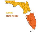
When people talk of “secession” in the United States they typically have Texas, Vermont, or the former Confederate states in mind, and the reasons for driving secession typically have to do with politics or money. Not anymore. The city of South Miami earlier this month passed a resolution which called for southern Florida to secede from the rest of the state, citing climate change as the reason. There are many differences between north and south Florida: South Florida is largely urban and politically tends to lean left, while the north is mostly rural and much more conservative. If south Florida reminds people of New York, the Florida panhandle resembles Alabama. Then there is this: The northern part of the state is, on average, 120 feet above sea level, but much of the southern section averages only fifteen feet above sea level. South Floridian say that the state government in Tallahassee ignores the perils of sea level rise, which are particularly acute in south Florida, so the time has come to separate from the aloof north.
-
-
New facility for hurricane research to study why some storms intensify so quickly
It still astonishes meteorologists. In the span of just twenty-four hours, Hurricane Wilma, the twenty-second named storm of the record-breaking 2005 Atlantic hurricane season, intensified from a tropical cyclone to a Category 5 hurricane — its wind speed soaring from 70 to 175 mph. As remarkable as Wilma’s rapid intensification was, however, it is not the only case of a storm muscling up at warp speed. As Hurricane Charley approached Florida’s west coast in 2004, its sustained winds jumped from 110 to 150 mph in only three hours. In 2007 Felix strengthened from a meager tropical depression to a Category 5 hurricane in fifty-one hours. This could all change soon now that the University of Miami’s Rosenstiel School of Marine and Atmospheric Science has opened its Marine Technology and Life Sciences Seawater Complex, a $50 million facility that houses a 38,000-gallon, 75-foot-long tank into which researchers pump seawater to study how the ocean and atmosphere interact — the critical air-sea interface that could tell us why some storms intensify so quickly.
-
-
U.S., U.K. war-game failure of too-big-to-fail banks
On Monday U.S. treasury secretary Jack Lew, his British counterpart Chancellor George Osborne, along with the heads of both countries’ central banks, participated in a simulation to test the actions that would follow should a major transatlantic bank went under. The scenario allows U.S. and British authorities to “make sure we can handle an institution that was previously regarded as too big to fail,” according to Osborne. War games have long been used to build trust and co-operation among allies and adversaries.
-
-
Debate continues over releasing Pennsylvania crude oil shipment information
Shipment of crude oil by rail in the United States has increased from 800,000 barrels a day in 2012 to 1.4 million in 2014. In western Pennsylvania, over seventy-five million gallons of crude oil are passing through Allegheny and Westmoreland counties to refineries in Philadelphia. Release of the recently classified rail transport records by Pennsylvania Emergency Management Agency (PEMA) was a result of a federal mandate ordering railway companies to share information on interstate shipments of crude oil with state emergency management officials.Railway companies claim that releasing the information threatens security and is commercially sensitive.
-
-
Disaster preparation business booms

Concerns about future manmade and natural disasters are driving the U.S. market for survival kits. Across the country, families are developing disaster plans, and some are even loading up on food and supplies to help them live through a biological attack, a catastrophic earthquake, or a pandemic flu. More and more businesses are targeting preppers, — people who actively prepare for a doomsday scenario.
-
-
Some states are better prepared than others for climate change challenges
In recent years, a number of states have started taking action to prepare their communities for climate change. Many have even developed specific adaptation plans to guide their work. Until now, though, no one has been able to define how much progress states are actually making in implementing those plans. The Georgetown Climate Center’s (GCC) online tool, the State Adaptation Progress Tracker, changes that. A GCC release says that now, anyone will be able to quickly determine how much progress their state is making and decision-makers will be able to learn from innovative examples of actions other states are taking.
-
-
The likelihood of a California Big One “uncomfortably high”: Experts

Research on the San Andreas fault has shown that the average time between surface-rupturing earthquakes is about a century. Experts say that these findings are a call to action. The last two “big ones” on the San Andreas fault — in 1906 in Northern California and 1857 in Southern California — occurred more than a century ago. There are several ways to calculate the probability of a similar earthquake, but they all give uncomfortably high results. A large earthquake is likely in our lifetime. A magnitude 7.8 earthquake is realistic, one expert says. “Our data show that similar earthquakes happened here in the not-too-distant past. As Shakespeare said, past is prologue. However, past large earthquakes on the San Andreas fault affected very few people. Now millions are at risk.”
-
-
Open data sources can help localities prepare for disasters
States and local governments must improve their use of open-data sources to prepare for disasters, according to a trio of emergency management experts from academia, government, and the private sector. Experts agreed that public data reveals an increasing need for infrastructure upgrades in U.S. cities, but local governments tend to adopt short-term measures over long-term protections.
-
- All
- Regional
- Water
- Biometrics
- Borders/Immig
- Business
- Cybersecurity
- Detection
- Disasters
- Government
- Infrastructure
- International
- Public health
- Public Safety
- Communication interoperabillity
- Emergency services
- Emergency medical services
- Fire
- First response
- IEDs
- Law Enforcement
- Law Enforcement Technology
- Military technology
- Nonlethal weapons
- Nuclear weapons
- Personal protection equipment
- Police
- Notification /alert systems
- Situational awareness
- Weapons systems
- Sci-Tech
- Sector Reports
- Surveillance
- Transportation
Advertising & Marketing: advertise@newswirepubs.com
Editorial: editor@newswirepubs.com
General: info@newswirepubs.com
2010-2011 © News Wire Publications, LLC News Wire Publications, LLC
220 Old Country Road | Suite 200 | Mineola | New York | 11501
Permissions and Policies
Editorial: editor@newswirepubs.com
General: info@newswirepubs.com
2010-2011 © News Wire Publications, LLC News Wire Publications, LLC
220 Old Country Road | Suite 200 | Mineola | New York | 11501
Permissions and Policies
