Critical infrastructure mappingInfrastructure security, disaster planning “Super map” developed
A U.S. Marine stationed at the Quantico base in Virginia has developed sophisticated mapping software that can give users full situational awareness of their surroundings in real-time; the software is a “super map” taking in a torrent of data streams from emergency dispatch reports to weather forecasts, traffic reports, and security system alerts

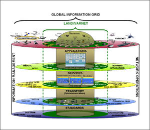
I-COP stacks multiple flows of information into a single picture // Source: ac.jp
A U.S. Marine stationed at the Quantico base in Virginia has developed sophisticated mapping software that can give users full situational awareness of their surroundings in real-time.
The Installation Common Operational Picture (I-COP), developed by Marine specialist Michael Lisovich, is essentially a “super map,” taking in a torrent of data streams from emergency dispatch reports to weather forecasts, traffic reports, and security system alerts.
Pete Streng, Quantico’s director of operations, said the tool, which is accessible online, essentially provides users with up to the minute information on everything around the base, allowing officials to make fast, informed decisions.
InsideNovareports that Streng contacted Lisovich several years ago requesting a system that would give officials a better grasp of the base’s critical infrastructure system.
Lisovich said in the past, generals would use layers of acetate to superimpose various battlefield conditions over a map. “He wanted something like that to show critical infrastructure. So I looked around and determined that GIS [Graphic Information System] would do that,” Lisovich said.
Based on that model, I-COP can impose roughly 500 layers of data and that number is growing. I-COP currently has feeds from antiterrorism officials and the CBRN officer on the base as well as outside sources like DHS’ infrastructure program, NASA, the Federal Emergency Management Agency, U.S. Geological Survey, the Pacific Disaster Center, the World Health Organization and the Centers for Disease Control.
For instance, with all this information available, if an earthquake hit near the base, I-COP can generate a map that shows the projected damage in a specific area and allow commanders to see if there were any hazardous material stored near there or if the nuclear power plant was damaged.
Meanwhile in the event of a major snowstorm, all of the roads on the map would turn red and slowly return to normal once they’ve been plowed. In addition, all of the base’s fire hydrants have been mapped and color-coded to indicate the last time they were tested or replaced.
“There’s really no limit to what you can do with it,” Streng said.
The map is also able to account for global phenomenon like disease outbreaks, which Lisovich said is critical to providing decision-makers with all the necessary information they need to give quick orders.
“A big part of this is not just emergency response, but also planning,” he said.
To prevent malicious actors from gaining access to all of the base’s critical information, I-COP has several layers of tiered access. At the most basic level is the Emergency Operations Center (EOC) Situational Awareness map, which is available to most people with a common access card. The map does not show “things you don’t want the bad guys to see,” Lisovich said. “This is the sanitized version of the I-COP for the public.”
This map is particularly useful during emergencies, where any member of the base can pull up the EOC and figure out what is happening around the base and what they should be doing. As an example, Lisovich pointed to a hypothetical hazardous material accident. With a few clicks, users can generate a model that displays the hypothetical hazard plume which also shows roadblocks, evacuation routes, and decontamination sites as well as instructions for individuals in different buildings.
“So now, instead of everyone trying to call in and find out what’s going on, everyone has access to what the situation is,” Lisovich said.
I-COP went live at Quantico on 1 February and Lisovich is currently helping other Marine Corps bases set up pilot versions of I-COP.
