Coastal resilienceSea level rise: NASA watching waters rise right outside the front door – pt. 2
The rate of sea level rise is faster now than at any time in the past 2,000 years, and that rate has doubled in the past two decades. If ice sheets in Greenland and Antarctica continue to melt as quickly as current measurements indicate, those numbers could become 21 to 24 inches by the 2050s and 43 to 49 inches by the 2080s. Half to two-thirds of NASA’s infrastructure and assets stand within sixteen feet of sea level, so NASA is facing the same problem faced by about 55 to 60 percent of U.S. citizens, who live in counties touching the Atlantic or Pacific Ocean, the Gulf of Mexico, or the Great Lakes. Across the space agency, from lab manager to center director to NASA administrator, people will have continually to ask the question: is it time to abandon this place and move inland? It is a question everyone with coastal property in America will eventually have to answer.
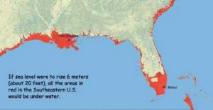
Nasa assets in jeopardy with sea level rise // Source: nasa.gov
Also see: “NASA watching waters rise right outside the front door – pt. 1,” HSNW, 8 September 2015
Different centers, common problems
The sea level concerns at Kennedy Space Center are the most visible, given the history and high profile of the real estate. But the issue touches the majority of NASA centers.
NASA’s Wallops Flight Facility, carved out of coastal marshland on the eastern shore of Virginia, is most like Kennedy in its vulnerability. Wallops had a prominent role in the early days of spaceflight before settling into a quieter role for several decades. In the past fifteen years, the facility has been redeveloped for launching NASA and commercial rockets, including the 2013 LADEE mission to the Moon. In the process, at least $1 billion in new spaceflight infrastructure has been set down along Atlantic shores.
Wallops sits amidst a barrier beach system, however, and those sand bars want to move. NASA says that erosion and beach migration has been reshaping the barrier island, Assateague, which sits north and east of Wallops.
Assateague has been losing ten to twenty-two feet (three to seven meters) of beach per year; Wallops Island has been losing about twelve feet. According to the Environmental Protection Agency, fifty acres (twenty hectares) of surrounding Accomack County are turning from farmlands to wetlands each year.
Hurricane Irene in 2011 did substantial damage to Wallops, leading NASA and local partners to redouble their efforts to hold back the tide. Coastal engineers built a sea wall 14-feet high and three miles long. By the time they finished in August 2012, more than 3 million cubic yards of sand had been pumped up onto the beach, part of a $43 million beach restoration project. A few months later, Hurricane Sandy removed 20 percent of the sand that had just been placed. Another 10 percent washed away in the months that followed, and another $11 million had to be spent to fix the walls and the beaches.
Situated near the third largest seaport in the United States and the nation’s largest naval base (Naval Station Norfolk), NASA’s Langley Research Center has to fight both rising seas and sinking land. Scientists have found that sea level around the Chesapeake Bay has been rising at 0.13 inches (3.4 millimeters) per year, twice the global average of 0.07 inches (1.7 mm) per year.