Disaster planningForecasters use Iron Dome science to handle disasters
Typhoons, floods, droughts, earthquakes, hurricanes, wildfires — the frequency and intensity of natural disasters across the globe are worsening, and these deadly events could continue plaguing the planet as a result of climate change. Iron Dome tech firm uses rocket science to enable utilities to plan for and manage effects of wildfires, storms, hurricanes and earthquakes.
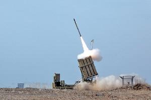
Israel's protective Iron Dome system turned to disaster preparation // Source: commons.wikimedia.org
Typhoons, floods, droughts, earthquakes, hurricanes, wildfires — the frequency and intensity of natural disasters across the globe are worsening, and these deadly events could continue plaguing the planet as a result of climate change.
Hoping to minimize disruption of essential services in disaster zones, government and utility officials are seeking better solutions for preparation and management of catastrophic weather events.
One new solution is a sophisticated product from mPrest Systems, the private Israeli company that famously developed the command-and-control software inside Israel’s Iron Dome missile-defense system.
Natan Barak, founder and CEO of mPrest, explains that the Major Event Management Application (MEMA) automatically forecasts the extent, location and progress of damage via a network of sensors and systems that jointly gather and analyze current weather and other relevant data using advanced algorithms.
“It is based on the same ‘system of systems’ architecture we developed for the Iron Dome,” he tells ISRAEL21c. “We are now applying rocket science, which was originally designed to save lives, to improve quality of life.”
How does that work?
“The Iron Dome is, in essence, a real-time distributed asset analytics and management system,” he explains. “The system accumulates data from tens of thousands of sensors to detect when a missile is launched, calculate its path, and decide if, when and where to intercept so that citizens and communities remain safe.”
That same technology can be integrated into, say, smart-grids and cloud-based irrigation systems. And in the case of MEMA, it helps utilities handle disasters.
Earthquake scenario
Let’s imagine, for example, that an earthquake is anticipated in a city like San Francisco.
First of all, MEMA would enable local utilities to develop simulation tools for a disaster plan by leveraging historical data from previous disasters.
Then, based on data from hundreds of thousands of sensors, the application would pinpoint high-risk areas where resources should concentrate in order to mitigate potential damage.
Once the quake hits, MEMA would automatically notify the utility, in real time, of incidents and continuously gather data from its sensors and systems — including satellite and drone imagery – to provide information on rising temperatures, rising wind levels, unusual ground motion, and more.
Barak says the application’s sensors can also do a “health check” of critical assets such as power lines and electrical transformers so that utility and other officials can make informed real-time decisions.