DisastersNew slippery slopes detection system developed
One result of climate changes has been that the number of avalanche threats has been increasing in the Alps and other alpine regions, with fatal consequences for people and infrastructures; continuous monitoring of every endangered area has been lacking until now because of high costs and manpower requirements; German scientists have now developed an inexpensive system, which, with the help of several technologies, can continuously monitor slopes, assess changes, and provide early warnings to communities potentially affected by landslides
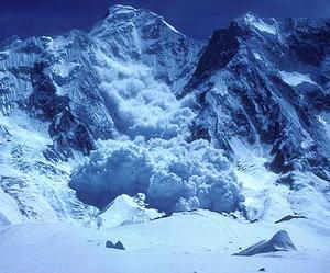
The devastating power of an avalanche // Source: theskichannel.com
One result of climate changes has been that the number of avalanche threats has been increasing in the Alps and other alpine regions, with fatal consequences for people and infrastructures. Continuous monitoring of every endangered area has been lacking until now because of high costs and manpower requirements. Geological researchers in Munich have now developed an inexpensive system, which, with the help of several technologies, can continuously monitor slopes, assess changes, and provide early warnings to communities potentially affected by landslides. The scientists hope to improve their understanding of these natural phenomena by means of long-term measurements.
A Technische Universität München release reports that identifying potentially dangerous mountain slopes is not difficult. Many of them have been unstable for centuries, and the remains of previous slides indicate prior disasters. In addition, geological records that reveal slopes at risk are available in Alpine countries. It has not been possible until recently, however, to monitor any unsettled masses continuously. In order to detect movements, experts had to insert probes into drilled pockets and measure marked points on the surface. Permanently installing such devices is normally too expensive to consider. Scientists can only do their inspections at intervals using this technique and gain limited insight about the events inside the slope.
The release notes that researchers at the Technische Universität München (TUM) and the Universitaet der Bundeswehr Muenchen have now made decisive progress in the development of geo-sensors and combined them with monitoring software into an early warning system that is both flexible and inexpensive to deploy. They can also drill into the ground at several locations. “We simply fill the drill pockets with basic coaxial cable, such as one uses for antenna cables, for example,” says Professor Kurosch Thuro, Engineering Geology Chair at TUM. The scientists use a simple but effective mechanism; if the surface mass of earth starts to slip, the cable will be crushed at the transfer point against the unmoving stratum. A small transmission device on the surface records this event and forwards the information. In addition, the Engineering Geodata Department at the Bundeswehruniversität (Prof. Otto Heunecke) distributes sensors, whose position can be determined by means of GPS, over the slope. Here also, the challenge lies in achieving precision measurements in the millimeter range using ready-made, inexpensive components for recording even the smallest movements.
As the third step, the scientists are using a new-generation measuring device, the so-called video-tachometer, which uses a