EarthquakesSatellite system to provide earlier earthquake warnings
British and Russian scientists are planning a satellite system that will monitor seismic activity from space in the hope of one day predicting the occurrence of earthquakes and volcanic eruptions.
The TwinSat project will put one micro-sized and one nano-sized satellite into low earth orbit some 400 kilometers apart, which will work in unison to collect and interpret electromagnetic signatures from the ground
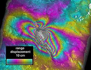
Satellite image showing shift in ground height // Source: nasa.gov
British and Russian scientists are planning a satellite system that will monitor seismic activity from space in the hope of one day predicting the occurrence of earthquakes and volcanic eruptions.
The TwinSat project will put one micro-sized and one nano-sized satellite into low earth orbit some 400 kilometers apart, which will work in unison to collect and interpret electromagnetic signatures from the ground.
Geologists have known for some time that as stress builds up in the earth prior to an earthquake, subtle electromagnetic signals are released. Prior to last year’s Haiti earthquake, sensors picked up electromagnetic signals from the area.
Present methods for collecting and analyzing seismic-related electromagnetic emissions, however, are too crude and not sensitive enough to be of any real predictive value, as project researcher Dr. Dhiren Kataria of University College London explained.
“The signatures are much too weak and the signal-to-noise level too high. Also, to be able to observe it, you need the sensors to be very close to the earthquake site and that is not always possible because most of our ground sensors are at fixed locations. On the other hand, when you’re up in space the noise is reduced and the spread of the signal is over a much wider region, so you can capture it far easier.”
The Engineer reports that the team, which comprises researchers from UCL’s Mullard Space Science Laboratory and Russia’s Institute of Physics of the Earth and International Science and Technology Centre, plan to launch the TwinSat in 2015.
The two linked satellites will then monitor zones with high seismic and volcanic activity, in particular Iceland and the Kamchatka Peninsula in the far east of Russia.
“The key thing that this project could add is a sense of time. You can easily say strain is increasing in an earthquake-prone area, but there’s no real indication when the earthquake may go. By measuring an additional parameter it gives you a better chance to do that,” said Professor Peter Sammonds, a geophysicist from UCL who is working on the project.
Currently the best earthquake systems, most of them in Japan, are based on measuring crystal strain in rocks and can give around three minutes of advance warning. In theory, a satellite detection system could offer far better preparation time and be useful for less-developed nations such as Haiti.
“The exciting thing about nano-satellite technology is it’s incredibly cheap. To make it really predictive you would have to have many more satellites to create a far larger coverage,” Sammonds said.
Professor Vitaly Chmyrev from the Institute of Physics of the Earth and Prof Alan Smith from UCL will head the project.