-
Alabama schools deploy 3-D virtual mapping to prepare responders
The Alabama Department of Homeland Security has recently institutionalized a detailed 3-D mapping system, called Virtual Alabama, which aims to create maps of public buildings in order to prepare responders in the event of a security emergency.The tactic behind Virtual Alabama is to immerse local responders to the intricacies of key structures before the knowledge is ever needed.
-
-
Encouraging innovation for better preparedness, recovery, and resilience tools
Last week the White House hosted innovators in technology and emergency management to discuss new tools that can improve preparedness, recovery, and resilience in the wake of a disaster. The White House Innovation for Disaster Response and Recovery Initiative Demo Dayshowcased innovations from the private sector and government agencies aimed at aiding survivors of large-scale emergencies. The key goal was to “find the most efficient and effective ways to empower survivors to help themselves,” said U.S. Chief Technology Officer Todd Park.
-
-
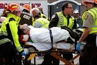
Plans for nationwide 911 dispatch centers advance
Municipalities across the country are planning to connect 911 dispatch centers in an effort to improve information sharing. Plan is to connect dispatchers via the Internet, which will allow centers quickly to transfer calls, 911 text messages, photos, videos of accident scenes, and other information. The technology is part of a “Next Generation 911” initiative already being implemented across the country.
-
-
DHS urged to investigate use of DHS grants for Motorola emergency comm. devices
Three senior House Democrats have requested DHS’s Office of Inspector Generalto investigate allegations claiming Motorola’s contracting tactics have led state and local governments unnecessarily to spend millions of dollars on the company’s proprietary devices, including its two-way emergency radio systems.
-
-
A drone finds natural disaster survivors through their cell-phones
During his semester project in Computer Science at the École polytechnique fédérale de Lausanne (EPFL), Jonathan Cheseaux developed a system for locating a person via his or her mobile phone with a drone. This device could be used to find victims in natural disasters.
-
-
Training volcano scientists from around the world to predict, respond to eruptions

Scientists and technicians who work at volcano observatories in eleven countries visited the U.S. Geological Survey’s Hawaiian Volcano Observatory earlier this month to learn techniques for monitoring active volcanoes. The International Training Program in Volcano Hazards Monitoring is designed to assist scientists from other nations in attaining self-sufficiency in monitoring volcanoes and reducing the risks from eruptions.
-
-
California braces for worst wildfire season in memory
California Department of Forestry and Fire Protection(Cal Fire) is bracing for one of the longest and most difficult fire seasons in memory. A recent addition of $23 million to the emergency wildfire budget for the fiscal year that began 1 July, brings the department’s budget total to $209 million. “That’s just the first week, and we still have 51 more weeks to go,” said Daniel Berlant, spokesman for Cal Fire. “We’re not even to the peak of the fire season yet.”
-
-
Emergency readiness of health-care providers
In 2013 the Centers for Medicare and Medicaid Services(CMS) proposed new preparedness requirements for hospitals and sixteen other types of health care providers, including home health agencies, nursing homes, hospices, transplant centers, and community mental health facilities, to mitigate natural and man-made disasters. Health-care providers say these requirements are too costly.
-
-
Firefighters mull using drones in fighting wildfires
Federal wildland firefighting officials are exploring the deployment of drones to assist in surveillance and reconnaissance missions during a wildfire. Drones sent to survey fire patterns during a wildfire could help keep firefighters out of risky situations by providing real-time information to officials on the ground. Few wildfire officials have used drones in the line of duty, and managers with the U.S. Bureau of Land Management(BLM) and U.S. Forest Servicesay that while the technology has potential, agencies do not have the budget and have not developed protocols to integrate drones into regular firefighting operations.
-
-
Iowa to allow public release of information about trains carrying crude
Iowa officials have announced that they will alert the public about trains carrying one million gallons or more of “extra-flammable” crude oil throughout the state — despite the argument of railroad companies that the information could pose a security threat. Iowa’s decision places the state in the spotlight as a possible model for how the rulings will proceed in the rest of the country.
-
-
Hazardous devices teams to compete at Robot Rodeo
Hazardous devices teams from around the Southwest will wrangle their bomb squad robots at the eighth annual Robot Rodeo beginning Tuesday, 24 June at Los Alamos National Laboratory.
-
-
Inexpensive seismic alert device may help Mexico City residents
Mexico City has been experiencing an unusually large number of tremors within the past few months, and though the country has one of the most advanced seismic alert systems in the world, many residents are unable to receive notifications before tremors occur. Mexican regulations limit the sale of government-issued earthquake alert receivers to one private company, but since the receivers cost an average of $310, most families are unable to afford them. Andres Meira, a 39-year-old architect, has designed an earthquake alert receiver, which costs only $54 at retail, which taps into the government’s earthquake alert frequency to notify its users of a pending earthquake.
-
-
Close air support technology helps in fire suppression
In the heat of battle, lives can depend on being able to coordinate troop positions safely while directing aircraft to provide close air support for ground forces. DARPA’s Persistent Close Air Support (PCAS) program aims to help overcome those challenges by providing soldiers with advanced digital tools for situational awareness and targeting in place of legacy communications systems and traditional paper maps. Firefighters battling wildfires face challenges very similar to those that troops face in battle — the need for situational awareness, precise coordination of airborne water drops and ensuring fellow firefighters are kept safe from rapidly moving and shifting flames. Technology developed for air-to-ground warfare has been adapted to help firefighters combat deadly forest blazes.
-
-
Free app alerts CPR-trained individuals to a heart attack case in their immediate vicinity
Speed and timeliness is instrumental to saving the life of a victim of cardiac arrest, so Santa Clara Countyagencies have adopted PulsePoint, a free mobile application (app) which uses location-based technology to alert CPR-trained residents and bystanders if someone in their immediate area is experiencing sudden cardiac arrest. Once alerted, residents can decide whether they are available to reach the victim and begin resuscitation until official emergency responders arrive.
-
-
New generation of aerial robots for high-risk missions
The need for robots able to carry out high-risk service tasks, such as the inspection of power plants and the cleaning of skyscrapers, is growing. Robots which actively interact with the environment without being constrained on the ground are well suited to such tasks.
-
- All
- Regional
- Water
- Biometrics
- Borders/Immig
- Business
- Cybersecurity
- Detection
- Disasters
- Government
- Infrastructure
- International
- Public health
- Public Safety
- Communication interoperabillity
- Emergency services
- Emergency medical services
- Fire
- First response
- IEDs
- Law Enforcement
- Law Enforcement Technology
- Military technology
- Nonlethal weapons
- Nuclear weapons
- Personal protection equipment
- Police
- Notification /alert systems
- Situational awareness
- Weapons systems
- Sci-Tech
- Sector Reports
- Surveillance
- Transportation
Advertising & Marketing: advertise@newswirepubs.com
Editorial: editor@newswirepubs.com
General: info@newswirepubs.com
2010-2011 © News Wire Publications, LLC News Wire Publications, LLC
220 Old Country Road | Suite 200 | Mineola | New York | 11501
Permissions and Policies
Editorial: editor@newswirepubs.com
General: info@newswirepubs.com
2010-2011 © News Wire Publications, LLC News Wire Publications, LLC
220 Old Country Road | Suite 200 | Mineola | New York | 11501
Permissions and Policies