Hurricane season2010 hurricane season is going to be a busy one
The 2010 hurricane season, which began 1 June, is going to be a busy one: the National Hurricane Center forecasts a 70 percent chance of eight to fourteen storms reaching hurricane strength, and three to seven becoming dangerous “major” hurricanes of category 3 and above
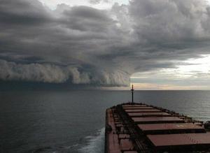
Approaching Hurricane Isabel off the North Carolina coast in 2003 // Source: brucewaynehart.com
The North Atlantic hurricane season officially began on 1 June, and the U.S. National Hurricane Center expects it to be a busy one. The agency forecasts a 70 percent chance of eight to fourteen storms reaching hurricane strength, and three to seven becoming dangerous “major” hurricanes of category 3 and above.
Reaching the upper end of that range would make 2010 one of the most active hurricane seasons on record (see “2010 hurricane season unusually active,” 3 June 2010 HSNW). What does that mean for residents of the Gulf and Atlantic coasts of the United States, worried about oil spreading from the Deepwater Horizon blowout? Jeff Hecht offers useful insights:
Was 2005 not “a once in a century” hurricane year? Why are a similar number of storms forecast this year?
If hurricane numbers were purely random, there would be a 1 in 100 chance of a hundred-year storm being followed the next year by a second hundred-year storm. The number of hurricanes, however, is far from random.
Hurricane formation in the north Atlantic and the Caribbean is linked to a cycle called the Atlantic Multidecadal Oscillation. In a cycle lasting twenty to forty years, sea-surface temperatures from Greenland to the equator rise and fall by about 0.5 °C. During the warm phases, about twice as many weak tropical storms grow into severe hurricanes as during the cooler phases.
The last rise in sea-surface temperatures and hurricane numbers came in the mid-1990s, so the average number of storms now is above the long-term average, and well above the relatively low numbers from the 1960s to the mid-1990s. The number of hurricanes was higher than average from the 1940s to the early 1960s. Those shifts roughly kept pace with the sea-surface temperature cycle.
What makes this year’s predicted peak temperature so high?
Even for the warm phase of the multidecadal cycle, sea-surface temperatures are unusually warm in the parts of the Atlantic and Caribbean where tropical storms usually form, increasing the likely number of storms.
Hurricane numbers also vary with the stage of the El Niño/southern oscillation cycle. Last month saw the dissipation of the El Niño episode, during which hurricanes are less likely. The National Oceanic and Atmospheric Administration reports that conditions from June through August will favor a shift to La Niña conditions, which favor hurricanes. So conditions are just about right for peak hurricane levels.
Have hurricane numbers not increased over the past century? Is that due to global warming?
More hurricanes are being reported, but that does not mean the numbers of hurricanes must have increased. Hecht writes that during the early twentieth century, short-lived storms in the ocean were likely to go unnoticed. Aircraft have regularly tracked storms since the 1940s, and satellite observations have covered the globe since the 1960s, so more storms are being reported.
The jury is still out on how future warming will affect hurricanes. “It’s not as simple as warmer oceans mean more storms,” says Gabriel Vecchi, at the NOAA Geophysical Fluid Dynamics Laboratory. The good news, says Vecchi, is that we might be able to cross off some of the more dire scenarios.
What if a hurricane hits the sea above Deepwater Horizon?
Even the fiercest hurricanes will not disturb the site of the leak 1,500 meters below the surface. Pipes and other equipment in deep water should be safe, as long as any parts extending to surface waters are secured.
A hurricane approaching the blowout site would force ships to evacuate the area, stopping efforts to contain the spill, and would imperil any temporary platforms brought in to cap the well. Hurricanes are not the only problem for ships trying to control the oil. The warmer temperatures of summer also bring thunderstorms, squalls, and high seas that can interrupt containment operations.
What would a hurricane do to the oil slick?
Hecht notes that what happens to oil on the surface will depend on a storm’s intensity and track. Winds circle anticlockwise around the eye of a hurricane, so a northward-headed storm would push the slick on its east side toward the shore, and the storm surge could drive large quantities of oil and dispersants well inland along much of the marshy Gulf coast. Winds on the western side of a storm blow to the south, away from land.
Rough seas around the storm would churn the oil and dispersants into the water, but that dilution could be good news if it speeded up bacterial digestion of the residue.