DisastersUsing river sediment to repair the coast
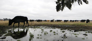
The water of the Mississippi River swells beyond levees and flood-control barriers, flooding large areas, destroying costly infrastructure assets, and inflicting economic harms; not all is bad, though: large floods like the current one carry huge quantities of sediment that eventually deposit on the riverbed, making the river shallower, or are carried out to the Gulf of Mexico; the vast amount of water going south will replenish Louisiana’s coastal wetlands, and the sediment carried by the water will restore long stretches of eroding coastline and rebuild barrier islands in the Gulf
Sediment from Mississippi flooding may save wetlands // Source: nola.com
As the already huge body of water in the Mississippi River swells beyond its normal man-made boundaries, the state of Louisiana is starting to see impact after having seen the damage already done to states from Missouri to Mississippi. As Near record-breaking water levels are expected any day now and safety precautions are being taken, one LSU professor explained how the river’s meandering historic path and silty contents may offer a future ray of hope.
“Historically, the Mississippi River is a meandering river, shifting its path pretty substantially over the past hundreds and thousands of years,” said Clint Willson, LSU associate professor of civil and environmental engineering and director of the university’s Vincent A. Forte River and Coastal Hydraulics Lab. “However, Louisiana, especially south Louisiana, relies on industry supported by the enormous number and size of ports. You can’t have a thriving port industry if the river you depend on constantly shifts, which is why we have restricted the river’s meandering over time.”
Large floods like the current one carry huge quantities of sediment that eventually deposit on the riverbed, making the river shallower, or are carried out to the Gulf of Mexico. In order to maintain the important navigation routes to the ports, the river must be dredged, which is an expensive process.
“What we need to consider is a way to efficiently capture flood water and sediment in a way that combines flood control and restoration benefits,” said Willson. “In addition to providing much needed resources to our coastal wetlands, this concept would also provide some redundancy for the flood control system. Of course, flood protection and public safety still needs to remain the number one priority.”
A Louisiana State University release reports that Willson, an expert in Mississippi River hydraulics and sediment transfer, has been studying the path sediment takes — or could take — over the lower eighty-four miles of the Mississippi River for years. His team at the Vincent A. Forte River and Coastal Hydraulics Lab, with the support of the Louisiana Office of Coastal Protection and Restoration, have used their small-scale physical model, or SSMP, of the river to study the potential for large-scale river and sediment diversions. One of the primary benefits of this model is that it only takes thirty minutes for them to model an entire year in river time. In other words, they can easily see the results from decades of sediment diversion operation over a very short period of time.
The 24 x 48-foot model, housed in a metal building next the levee on River Road, helps Willson and Louisiana officials evaluate potential sediment diversion locations and strategies. Experimental results from the SSPM are being used along with numerical model simulations to provide insights that help guide diversion planning and design.
“We would like to locate and design a diversion system that more effectively captures sediment. The Mississippi River is a wonderful natural resource, but currently we are not fully utilizing these resources,” he said. “Many of our coastal wetlands are in need of river water and sediment. With proper management and perhaps integration with flood control measures that take into consideration public safety and economic impact, we can harness all the qualities we’re not currently taking full advantage of.”
Currently, a project is underway to develop a model that will be large in scale and size, more than four times the size of the SSPM now housed in the Forte lab.
With a model that size, we can look at the river all the way up to Donaldsonville and better study the management of the river and its resources within the context of both flood control and restoration,” he said. “But until then, there’s plenty of work to do right where we’re at now.”