-
Up to 30 percent less precipitation in the Central Andes in future
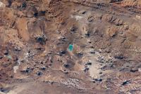
Seasonal water shortages already occur in the Central Andes of Peru and Bolivia. By the end of the century, precipitation could fall by up to 30 percent according to an international team of researchers. Researchers show that precipitation in the rainy season could drop noticeably - and this could happen within the next twenty years.
-
-
Interior Dept.’s National Seed Strategy to guide post-disaster rehabilitation, restoration
As part of what it describes as a comprehensive, science-based strategy to address the threat of wildfires that are damaging landscapes across the West, the Department of the Interior announced the release of a National Seed Strategy for rehabilitation and restoration to help foster resilient and healthy landscapes. The strategy is meant to guide ecological restoration across major landscapes, especially for those lands damaged by rangeland fires, invasive species, severe storms, and drought.
-
-
Warming-driven substantial glacier ice loss in Central Asia imperils water supplies
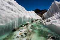
Central Asia is the outstanding case for human dependence on water seasonally delayed by glaciers. Nowhere the question about the glacier state is linked so closely to questions of water availability and, thus, food security. The glaciers in Central Asia, however, experience substantial losses in glacier mass and area. Along the Tien Shan, Central Asia’s largest mountain range, glaciers have lost 27 percent of their mass and 18 percent of their area during the last fifty years. Scientists estimate that almost 3,000 square kilometers of glaciers and an average of 5.4 gigatons of ice per year have been lost since the 1960s, saying that about half of Tien Shan’s glacier volume could be depleted by the 2050s.
-
-
Interior Dept.’s National Seed Strategy to guide post-disaster rehabilitation, restoration
As part of what it describes as a comprehensive, science-based strategy to address the threat of wildfires that are damaging landscapes across the West, the Department of the Interior announced the release of a National Seed Strategy for rehabilitation and restoration to help foster resilient and healthy landscapes. The strategy is meant to guide ecological restoration across major landscapes, especially for those lands damaged by rangeland fires, invasive species, severe storms, and drought.
-
-
In the Pacific Northwest, fear of the Big One should be channeled into pragmatic action
Scientists believe that a magnitude 9.0-plus Cascadia Subduction Zone earthquake — which they call “the largest of the large” — would likely trigger a tsunami that could devastate coastal communities, while the earthquake could destroy infrastructure throughout western Oregon and Washington, including roads, bridges, water and sewer lines, and the power grid. Scientists say, however, that the more probable scenario is an earthquake on “the average side of large,” where the damage is less. Rather than focus on the most extreme scenario – which can lead to fatalism or to people fleeing the region – scientists urge residents of the Pacific Northwest to become pro-active in preparing for a disaster which, if preparations are made, can be survived.
-
-
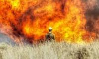
People living in wildfire-prone areas underestimate their risk
The vast majority of people living in areas prone to wildfires know they face risk, but they tend to underestimate that risk compared with wildfire professionals. At the same time, they tend to over-estimate the importance of specific risk factors beyond their control — such as the composition of vegetation on their property — while giving less heed to those they can mitigate, such as replacing combustible siding with more fire-resistant materials.
-
-
Worries about megaquake benefit preparedness, retrofitting businesses in Pacific Northwest
The sale of emergency preparedness kits has been booming in the Northwest of the United States, as more press stories have highlighted the growing confidence of scientists that the Pacific Northwest is overdue for a megaquake. Stores that sell a few preparedness kits a month, and which typically cater to survivalists, see a dramatic increase in business, as do businesses which retrofit houses to make them more quake-resilient.
-
-
Big Data, Internet of Things enable real-time probabilistic risk analysis
Statistical models are playing an increasingly important role in risk analysis and helping the United States and other countries around the globe mitigate the effects of natural and man-made disasters. With the increased ability to collect data through the Internet of Things and analyze this data in real time, the field of risk analysis is entering an exciting new phase based on real-time probabilistic risk analysis. This emerging paradigm can enable humans to better manage risks associated with complex systems, including space shuttles launching into orbit, illicit nuclear materials crossing national boundaries and the side effects of chemicals and even medical drugs.
-
-
Origami-inspired, fuel-saving shelter for soldiers, disaster victims

Soldiers are often stationed in extreme environments, from desert to mountain conditions. The military spends millions of dollars every day on fuel for air conditioning or heat. A team of engineers had a goal: design a shelter for soldiers or disaster victims that could be quickly deployed in the field, but also reduce fuel consumption in heating and cooling. The team drew inspiration from origami, the ancient art of folding paper into eye-catching creations.
-
-
Tackling urban water crises
With drought conditions putting a strain on resources throughout South Florida, FIU researchers are investigating long-term solutions to water crises as part of a newly launched consortium. The Urban Water Innovation Network (UWIN) comprises fourteen academic institutions and key partners across the United States. The UWIN researchers hope to create technological, institutional, and management solutions that will help communities increase the resilience of their water systems and enhance preparedness for responding to water crises.
-
-
If climate trends continue, Manhattan climate index will resemble Oklahoma City today
In a few decades, climate change caused by greenhouse gas emissions will alter the way that Americans heat and cool their homes. The number of days each year that heating and air conditioning are used will decrease in the Northern states, as winters get warmer, and increase in Southern states, as summers get hotter. In the future, the amount of heating and cooling required in New York City will be similar to that used in Oklahoma City today. By this same measure, Seattle is projected to resemble present day San Jose, and Denver to become more like Raleigh, North Carolina, is today.
-
-
Building resilient urban infrastructure to cope with climate challenges
In addition to urban flooding, global climate change is predicted to bring increased coastal flooding, like that associated with Hurricane Katrina and Superstorm Sandy, as well as extreme heat. As extreme weather events like these occur more frequently, global climate change may demand that we recalibrate our definition of “rare.” Historically, infrastructure to mitigate flooding and extreme heat has been designed to be fail-safe, meaning that it is designed to be fail-proof. But recently we have seen that fail-safe can be a dangerous illusion. Fifty researchers from different disciplines from fifteen institutions have teamed up to explore these challenges and to change the way we think about urban infrastructure.
-
-
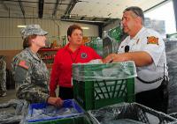
Historic drought complicates firefighting in California
The twenty-one wild fires which have erupted in different parts of the state have already cost lives, dozens of homes, and millions of dollars in damages. To fight fires, firefighters need water – and although state water and fire officials say that, so far, there is no danger of running out of water, they are conscious of the state’s water predicament and they are trying to be more careful in the use of water. The persistent drought has forced crews to get creative, using more dirt and retardant on wildfires. Firefighting response to several blazes has been slowed down by the drought, because firefighting helicopters found it impossible to siphon water from lakes and ponds where water levels were lower than in previous years. In the past, property owners whose properties were threatened by fire, would allow firefighting crews to tap water on their property, and would then be compensated by cash reimbursements from the state. Now, many property owners demand instead that the state replenish the water used by firefighters to protect the owners’ property.
-
-
Pentagon: Climate change aggravates U.S. security risks
Global climate change will aggravate problems such as poverty, social tensions, environmental degradation, ineffectual leadership, and weak political institutions that threaten stability in a number of countries, according to a report the Defense Department sent to Congress last week. The report finds that climate change is a security risk, Pentagon officials said, because it degrades living conditions, human security, and the ability of governments to meet the basic needs of their populations.
-
-
Improving West Coast earthquake early warning system
UC Berkeley is among four universities to receive grants last week from the U.S. Geological Survey (USGS) to help bring the planned ShakeAlert earthquake early warning system toward a production stage. Among other tasks, the partners also will continue development of scientific algorithms rapidly to detect potentially damaging earthquakes, more thoroughly test the system, and improve its performance.
-
The long view
Risk Assessment with Machine Learning
Researchers utilize geological survey data and machine learning algorithms for accurately predicting liquefaction risk in earthquake-prone areas.